Five Days, One Bear, and 77 Miles: A Foothills Trail Thru-Hike
This post was contributed by Richard Shane Thomas, documenting his and his brother’s thru-hike of the Foothills. Thanks for contributing your trail guide Shane!
Here are the highlights of our thru-hike of the trail this week, along with some of the pictures I took. If you make it to the end, I owe you a beer, but you will have to come to Carolina Beach to collect.
My brother and I have been working towards doing a thru-hike of the AT together. As neither one of us is retired, that has proven difficult. We did manage to do a section hike of the AT, which was somehow eight years ago now. We also discussed doing a thru-hike of the Sheltowee Trace trail in Kentucky, which is currently 343 miles long, still a distance difficult to manage using only PTO from a regular day job. We decided to find a hike we could manage in a week, but still challenging enough to give us lessons to apply when we are able to do the big hike.
We decided on the Foothills trail in North and South Carolina because it is a drivable distance from us and, at 77 miles, long enough to provide a moderate challenge. Details on the hike to follow, but first some major lessons learned.
1. Expect equipment failure/loss – one pair of my socks gave out the first day, my brother’s rain fly had lost its waterproofness, I lost my camp stove, cookpot, and spork, which were in my bear bag, which I also lost.
2. Speaking of bear bags, there may not always be a good place to hang your bag that is convenient. I knew the tree I used was probably a little low, but I was tired and didn’t feel like a long trek just to hang my food bag. Going forward, I will switch to a bear canister. The additional weight is worth the added safety and convenience to me.
3. Don’t be too aggressive in the beginning – We did some big mileage days (for us), finishing the trail on the last day with 22 miles, and completed the whole trail in 5 days. For a relatively short trail, that was sustainable, but we would have burned out quickly on the AT at that rate. We decided we would do no more than 12 miles per day for the first week, no matter how good we might feel, and build up to the bigger miles.
4. Also, big miles aren’t the point – If I were to do the Foothills trail again. I would take at least 10 days to do it, so I could hit more of the side trails and not speed past the scenery.
5. Food planning – For a weeklong hike, I planned to eat the same thing every day. By day 2, I had discovered that what I had planned for my lunches made me a little sick to my stomach. The bear kind of saved me from myself. I also discovered that instead of having lunch, stuffing my pants with snacks I could access throughout the day was more convenient and satisfying than taking a “lunch break.” I still like and plan to have a hot meal at the end of the day. For a longer hike, like the AT, I’ll put some more thought into adding variety to what I’m eating.
6. Filtering water is not a time waster. It is an opportunity to rest. I’m in my mid-50s. I’m ok with taking a break when I need to.
7. Footwear – having the right shoes is critical. I had planned to switch out between a pair of Keens sandals and a traditional pair of hiking boots. I already knew the hiking boots I have make my feet sweat, and I have to rotate my socks every few hours to prevent blisters. After being reduced to only one pair of socks, I was forced to wear the Keens all week. They held up well, but getting forest trash in them was a bit of an issue, and I did have a few hot spots on my toes, and a raw spot on my ankle where the leather rubbed. I plan to experiment with trail runners in the future. Also, I want a lightweight pair of slides for camp shoes to give my feet more opportunity to breathe.
8. The Far-Out app is worth the money. It made planning our day so much easier.
9. Bring something to write in. Phone battery is too precious to use up for writing notes to yourself. I wish I had chronicled the hike daily. Now I’m struck trying to recreate it from memory. That shouldn’t be too hard for a 5-day hike, but it would be impossible for a hike like the AT.
I may add more later as I remember them, but that's all for now. To the hike.
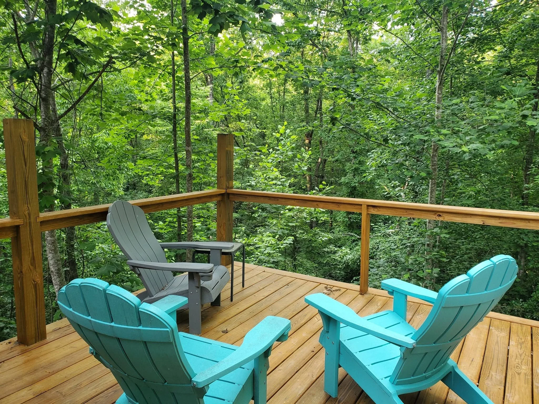
Day -1 – We stayed in a “hostel” which was a room over a garage at a local woman’s house who supports the hiker community in the area. The place was smaller than a standard hotel room, but beautiful, with a shower, TV, a good selection of books, and a nice outdoor seating area backed up to the woods. I would have enjoyed staying there even if I hadn’t been planning to hike the trail.
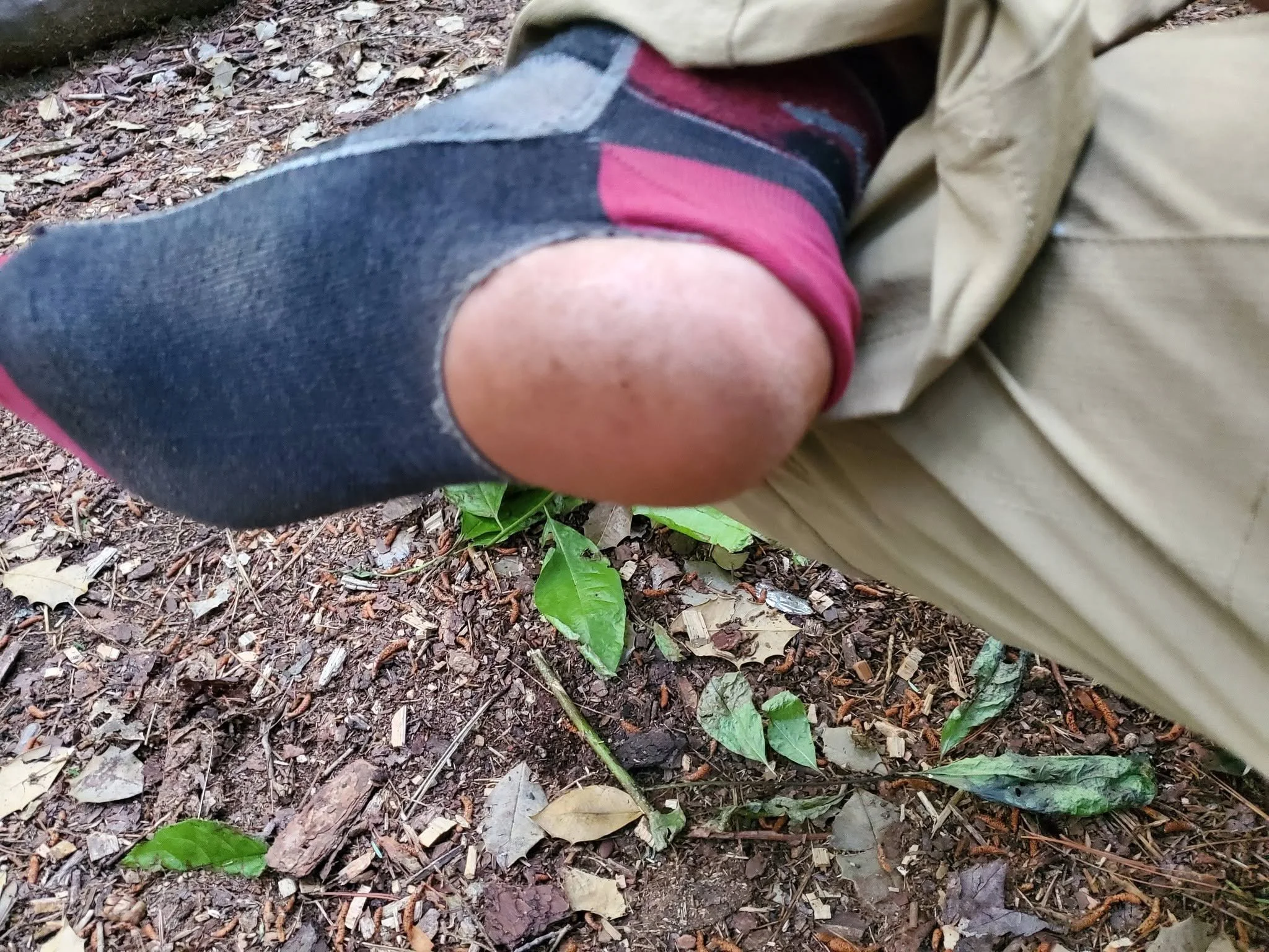
Day 1 – We had to arrange long-term parking for our vehicle at the visitor center, which opened at 8:00, and met our shuttle driver who took us to the beginning of the trail and also provided us with a food cache storage toward the midway point so that we didn’t have to carry all of our food from the beginning to the end. We made it to the trail a little before 10:00. Being summer, the forest canopy provided almost continuous shade for us. Shortly after getting on the trail, we came across a box turtle who seemed unbothered by our presence, and we let him be. We were also passed by a group of teenagers, or possibly college-age adults, who looked like they were planning an overnight stay, but not a thru-hike. We passed each other multiple times throughout the day as we each stopped for water or to rest. We passed them for the last time in the early evening as they had found a nice spot on the riverbank to camp for the night. We pushed on to later in the evening and stopped at the Burrell’s Ford Campsite, which gave us about 16 miles for the day. Too many miles, really, for such a late start, and we were both exhausted. I discovered that one of my socks had developed a giant hole in the heel, and I was reduced to one pair of socks for the week. The campsite did provide a bear box, which we used.
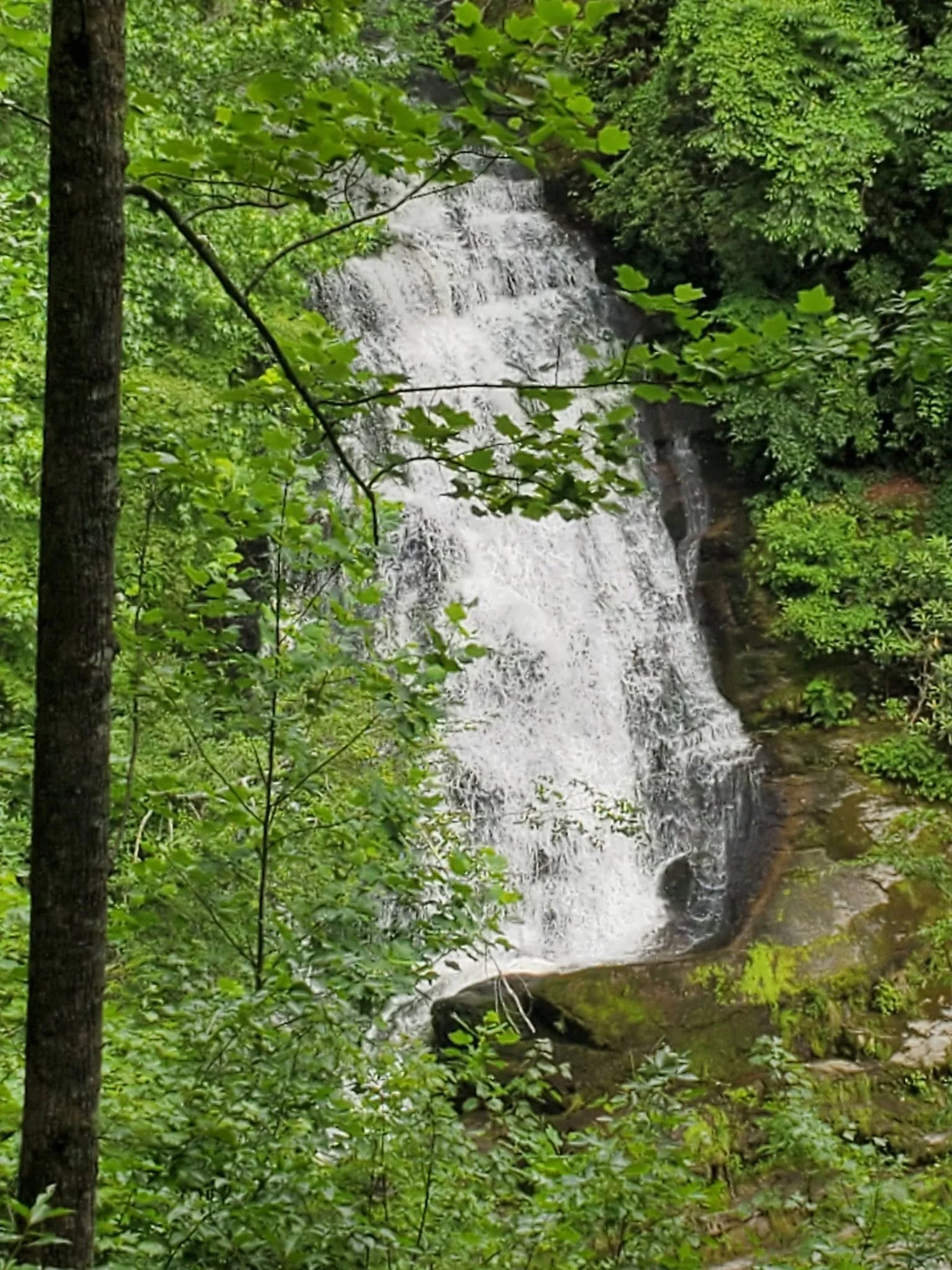
Day 2 – We woke up early, but took a long time to break from camp and did not get on the trail until about 8:00. We took a side trail to King’s Creek Falls. It was beautiful, and we spent a little time here, which was part of why we only got about 11 miles in the positive direction on the trail that day. We did not see much wildlife, but there were lots of snails on the trail, and I spotted an orange salamander, which I learned after the hike was an Eastern Newt. We saw four of them in total for the week. We pitched camp at an unnamed campsite near the Girl Scout Benches.
There was one tree that looked appropriate for a bear bag hang, but my bag line kept getting stuck in the surrounding trees, so I gave up and used a less ideal tree and hoped for the best. During the night, our campsite was invaded by raccoons twice. They tried to get into my brother’s bear canister, but were unsuccessful. They rifled through his bag and took or destroyed a couple of items, including his wallet and phone, presumably so they could make some calls and buy beer in town. I had always assumed that raccoons would be stealthy, but these sounded like invading elephants. If we had not seen them, we would have thought they were bears.
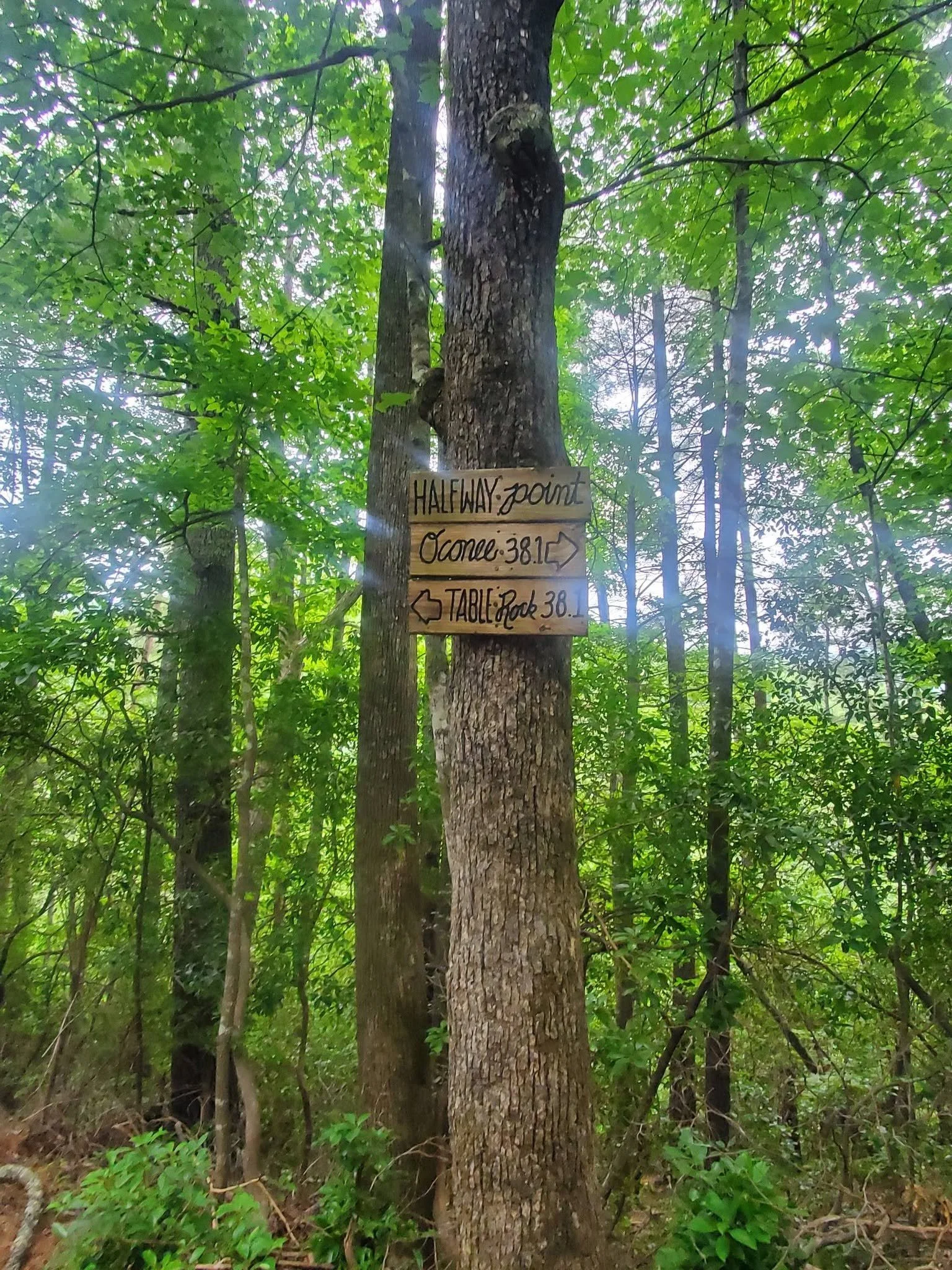
Day 3 – We woke to find that a bear had indeed gotten to my bear bag and made off with all of the food I was carrying, plus my spork, cookstove, and cookpot, which were also in the bag. We happened to be close to a spot with cell service and messaged our shuttle driver to ask if she had a bear canister we could buy or borrow for the week. She quickly responded positively, and we arranged to meet at the food cache, which was only two more miles down the trail from where we were. We met about an hour later, and she had the bear canister. We also needed fuel for my brother’s cookstove, which used alcohol rather than the propane mine used. This was our lowest point on the trail, and we both briefly considered calling it a wrap on our hike. Our shuttle driver offered to make a second trip to get the fuel we needed and met us farther down the trail so we didn’t lose much hiking time. She even hiked at least a mile along the trail to meet us, which saved us time, and we ended up logging some decent mileage for the day. We stopped about a mile beyond the official halfway point of the trail marked as “Secluded Campsite” on the Far-Out App. Shortly after we finished setting up camp, it began to rain, and we stayed in our hammocks for the rest of the evening until the next morning. My brother discovered that his rainfly had lost its waterproofing, but managed to rig an emergency mylar blanket that kept him somewhat dry throughout the night. We did not have any nightly visitors.
Day 4 – The rain had mostly stopped when we woke, and we never reached a point where we considered the need for rain gear. After crossing the largest suspension bridge we would encounter on the trail, we reached “Heartbreak Ridge,” which looked quite steep. We could gauge how high we needed to climb from the bottom, and we chose not to consult the Far Out App for that information. We did what we considered a strenuous climb and reached the “top,” where there was a bench, and we sat on it for several minutes, congratulating ourselves on our achievement, only to discover that we were only about halfway to the top. At the end of day 4, we camped at Dawkins Flat Campsite, which was 21.4 miles from the Table Rock trailhead. There was a nearby stream that provided water and nice background noise while we slept
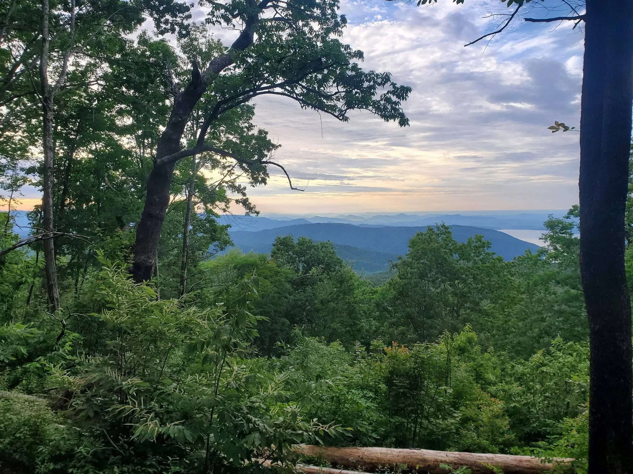
Day 5 – We started the day with a plan to do 14 to 15 miles and leave ourselves a short day to finish up and drive home. We made it to the Sassafras Observation Tower at about 1:00pm (about 10 miles from the Table Rock trailhead), but not before encountering a likely poisonous snake that crossed the trail between my brother and me. It didn’t stick around long enough for a photo, and I was okay with that. It was just starting to rain, and the mountains were absolutely gorgeous. I quickly took as many pictures as I could as the rain fell harder, making it difficult for my phone’s camera to function. Within minutes, the mountains were lost in a thick fog, and we could no longer see anything from the tower. My camera didn’t capture much of them either. We took shelter under the tower for several minutes, speaking with a family from Montana who said they were traveling to the highest point in each state and were headed to Florida from there. We weren’t sure how long the rain would last, but we were concerned about spending another night in the rain, wet and cold. We decided we would finish the trail and drive home. We put on our rain gear and headed down the mountain. The first 5 miles were relatively easy. The last 5 miles were somewhat more difficult, amplified by our exhaustion at that point. The rain had stopped by then, and we would have been wise to call it a day, but like Harold and Kumar in search of White Castle, only one option would satisfy us. We finished the trail at about 8:30, just as we lost the last of the daylight. Unfortunately, we came out the wrong trailhead and could not find our vehicle. I tried to send a message to our shuttle driver to ask how to get to our vehicle, but there was no service, so I decided to backtrack and take what I thought would be the proper trail. At this point, I needed my headlamp. Shortly after reentering the trail, I got a spot of service and instructions from our shuttle driver on how to find my vehicle. I continued on the trail for a bit, thinking I was close to where I should be, but realized I was only heading back up the mountain, so I returned the way I had come, grateful I did not get lost in the dark. We were able to find our vehicle with her instructions and drove home after returning the bear canister. In hindsight, we should have taken the room she offered us for the night, as we did not reach home until after 5:00am the next morning.
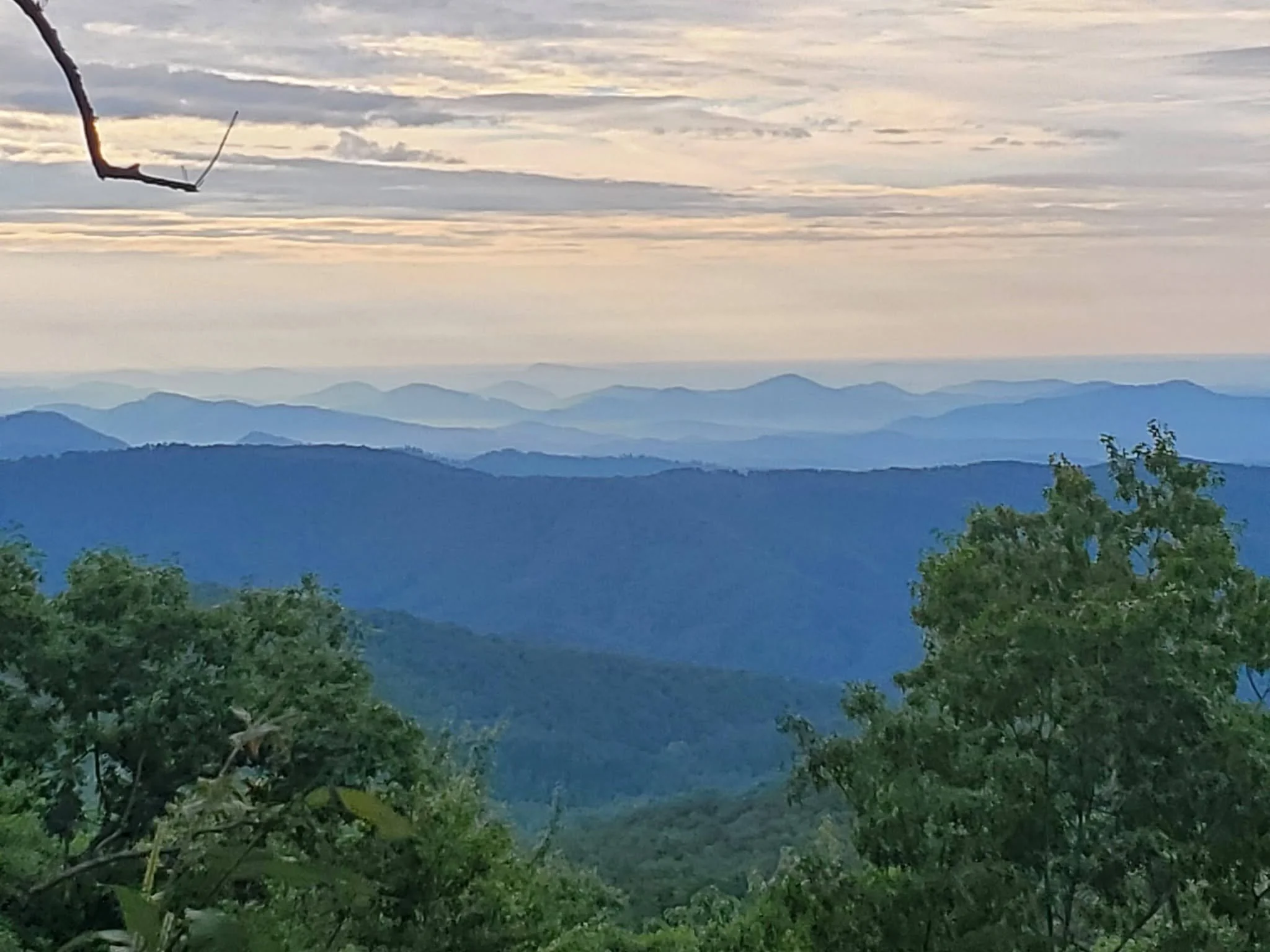
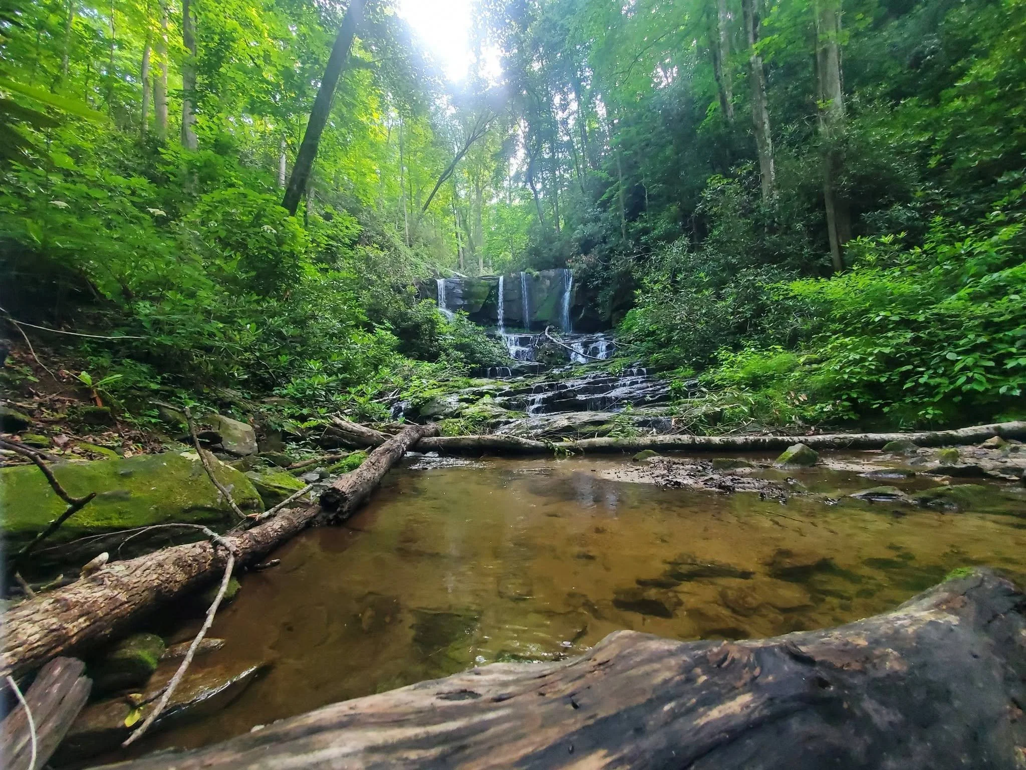
General observations from the whole hike – lots and lots of waterfalls. Even more if you are willing to do some of the side trails. Wintertime would be better for mountain views, as many overlooks were obscured by summer foliage. The western side was more physically challenging. The eastern side offered more and better views. The trail is not crowded at all. I don’t know if other times of the year are busier than when we went, but I believe the trail is underutilized for how beautiful it is. If I were to hike it again, I would take more time and enjoy the scenery more. If you haven’t already hiked this beautiful trail, put it on your list.